

AP20 AutoPole
A revolutionary smart system for Leica robotic total stations that is easy to use and enhances your workflow. The TargetID functionality makes sure that your total station is locked to your target and remains locked until your job is done. The PoleHeight feature automatically updates the correct pole height within the field software every time you adjust your pole. Tilt Compensation provides flexibility to measure or layout points without the need to level the pole!


C-Thrue Concrete Scanner
The concrete scanner C-thrue is an easy-to-use and robust solution to see through concrete structures and reveal true data that lead to optimal decision-making. The solution is suited for all construction sites and operations including building renovation, overpasses, monuments, bridges and tunnels surveys, as well as for detailed analysis of the original engineering project and comparison with the as-built structure.


Manual Construction Total Station
The Leica iCON iCB70 manual construction total station makes you layout more points per day on your construction project with either prism or reflectorless measurements. Equipped with the construction-tailored and easy-to-use software platform iCON build, the Leica iCON iCB70 manual construction total station guarantees efficient layout and as-built tasks. Forget about paper plans, tapes, plumb-bobs and chalk-line that cause error-prone layout jobs on your construction site. Leica Geosystems’ new manual construction total stations support you in your no-tapes and no-strings approach to construction layout.


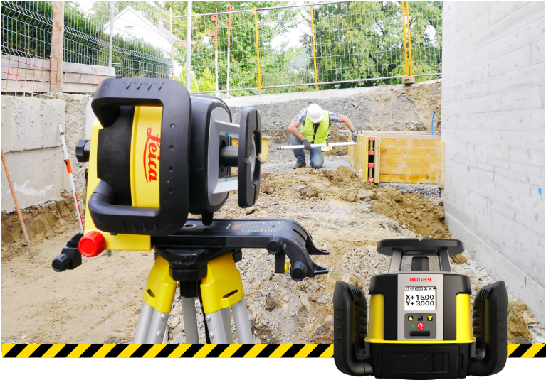
CLA-ctive Rugby Rotating Lasers
You asked, they listened! Introducing Leica’s new rugby lasers with the ability to dial in grade on the face. They no longer require the combo remote, giving you the ability to choose your receiver based on your desired laser functions
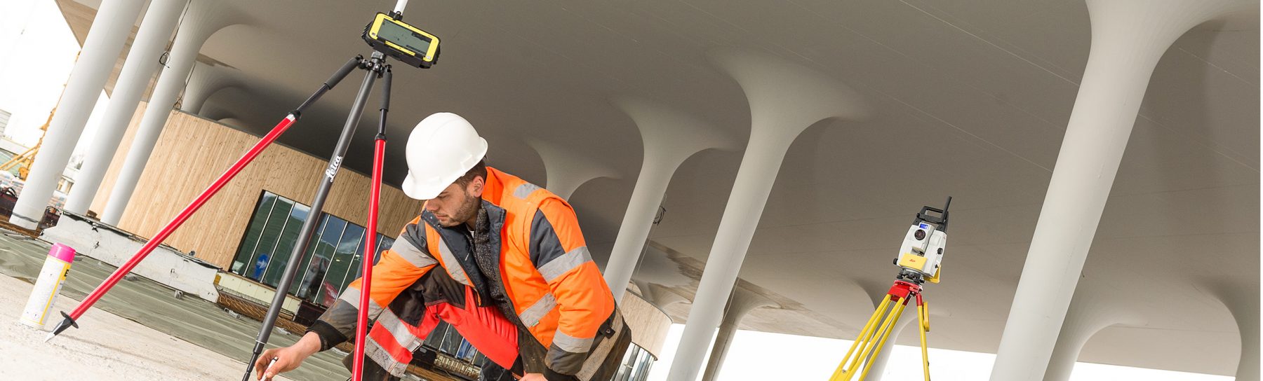
Robotic Total Stations and GPS
Leica’s new iCON ICR70 Robotic Total Station helps facilitate the move from the traditional analogue measurement methods to modern digital technologies. The ICR70 allows users to:
- Layout lines for footings or chalk line for formwork on foundation
- Layout points on blinding layer such as pipe insert or cut-outs before pouring concrete
- MEP layout of hanger locations for HVAC and duct work, inserts and slits for sheet metal work
- Fully automatic layout routines of points on floor or ceiling and lines for pipe wall penetrations


Preparing and execution of construction tasks have never been faster, simpler or more accurate. This robot, tailored to your construction needs, is designed for one-person operation, giving you approximately an eighty per cent increase of productivity over other conventional layout practices
The recent innovation doesn’t stop there. Leica has recently introduced its new iCON GPS 70T. Combining the latest GNSS technology and inertial measurement unit (IMU) the GPS 70T is equipped with permanent tilt compensation (no need to keep the pole vertical and level the bubble!) and as well resistant to any magnetic interferences. Being calibration-fee, the iCON GPS 70T is ready when you are – anytime, anywhere


